

Last week I blogged a brief piece about the increasing seismic activity in at the Yellowstone supervolcano site. Since then I've seen the story carried at dozens of internet sites, with a general consensus that it's not really all that important; Garrison Keillor, however, offered the following observation:
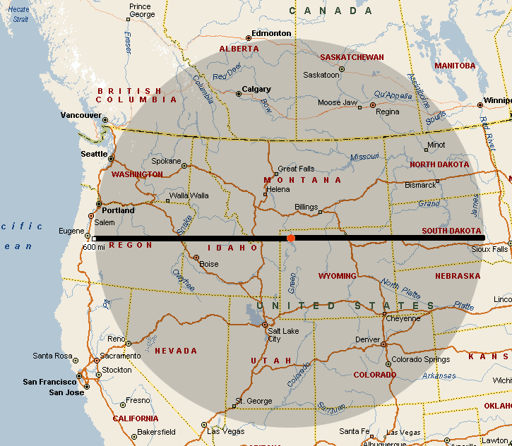
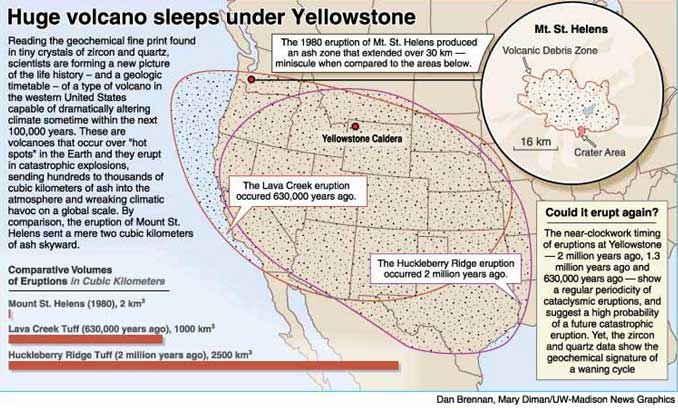
A Yellowstone spokeswoman says, "There doesn’t seem to be anything to be alarmed about." When a government spokeswoman says that, a person looks around for the nearest exit.Today I found two maps. The first shows the area included in a 600-mile radius around the caldera - often quoted as the area to be covered with ash from an eruption. The actual area affected would be determined by prevailing winds, so the other map shows the actual ashfall areas from the two previous supervolcano eruptions (630K and 2.3M years ago).
All of this mapping of areas is tongue-in-cheek ridiculous, since a true supervolcano eruption would probably plunge the entire earth into an ice age. The map only tells you the likelihood of smothering in ash vs. starving in the cold.

No comments:
Post a Comment